
The natural Pacific weather phenomenon known as El Niño—famed for driving up global temperatures and triggering chaotic weather shifts—has officially begun, according to atmospheric scientists in the United States.
The U.S. National Oceanic and Atmospheric Administration (NOAA) declared that El Niño conditions have solidified across the tropical Pacific Ocean, fueled by a sharp, rapid rise in sea surface temperatures over recent months.
Worryingly, advanced predictive climate models suggest this phase could rapidly intensify into a rare “super” El Niño, potentially ranking among the most severe oceanic warming events ever recorded.
Ocean and Atmosphere Align
The official declaration comes as no surprise to meteorologists, who anticipated the transition following the collapse of the multi-year, cooling La Niña pattern earlier this year.
To trigger a formal El Niño declaration, sea surface temperatures in the central and eastern equatorial Pacific must cross a critical threshold of 0.5°C above the long-term baseline. Recent data shows the ocean has comfortably breached this margin.
“El Niño conditions developed over the past month, as shown by above-average sea surface temperatures (SSTs) across the central to eastern equatorial Pacific Ocean,” NOAA confirmed in its climate diagnostic brief.
Crucially, scientists noted that atmospheric winds above the equator have also begun to weaken and shift. This atmospheric synchronization proves that the phenomenon is no longer just a localized oceanic anomaly, but a fully coupled, self-sustaining climate event.
The Threat of a Historical “Super” Event
What has caught researchers off guard is the unprecedented confidence and speed with which global supercomputers are predicting the event’s ultimate intensity.
An El Niño’s severity is gauged by how drastically temperatures spike in a designated zone of the Pacific:
-
Strong Event: Classified at 1.5°C above average.
-
Very Strong Event: Classified at 2.0°C or higher above average.
According to NOAA’s mid-year outlook, there is already a 63% chance of a very strong El Niño peaking between November and January. An event of that magnitude would place it alongside the three most devastating climate anomalies on record: 1982/83, 1997/98, and 2015/16.
Even more alarming, several cutting-edge U.S. and European (ECMWF) models go a step further, projecting that equatorial waters could skyrocket to an astonishing 3.0°C above average by the end of the year.
Economic and Weather Chaos Looming
When mapped over decades of baseline human-induced global warming, the arrival of a massive El Niño threatens to push global climate systems into uncharted territory.
Climatologists warn that while immediate weather anomalies will emerge over the coming months, the compounding thermal energy will likely make 2027 the hottest year in recorded human history.
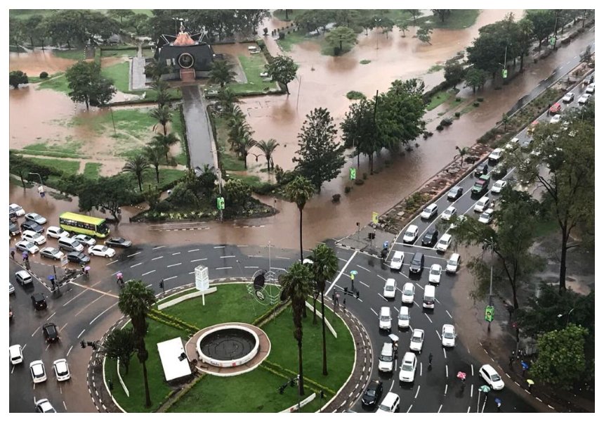
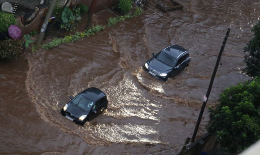
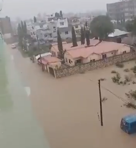
The ripple effects are expected to cause severe economic, agricultural, and humanitarian disruptions extending well into late 2027. Historically, strong El Niño phases completely flip global precipitation patterns, triggering catastrophic flooding across East Africa and parts of South America, while simultaneously plunging Australia, Indonesia, and parts of southern Africa into severe, crop-failing droughts.
However, NOAA officials urged governments and policy planners to focus on regional preparedness rather than getting bogged down by absolute numbers.
“Even very strong El Niño events do not lead to the expected impact everywhere,” the agency cautioned. “But stronger events can more significantly tilt the odds in favour of expected outcomes.”